In the Poché
Michael Young - Young & Ayata
The Nuova Pianta di Roma by Giovanni Battista Nolli, engraved in 1748, known as the Nolli Map abstracts the city into figure and ground; the spaces of roads, squares, and the quasi-public of civic-religious interiors are left blank, while the mass of the built is hatched black. The Nolli Map renders the city as an […]
The Nuova Pianta di Roma by Giovanni Battista Nolli, engraved in 1748, known as the Nolli Map abstracts the city into figure and ground; the spaces of roads, squares, and the quasi-public of civic-religious interiors are left blank, while the mass of the built is hatched black. The Nolli Map renders the city as an intelligible public ground against the solid fill of the inaccessible private interior of architecture. The engraving visualizes the city through the graphic hatch of poché. In this drawing, the abstraction of a planar cut floating above the ground coupled with the aesthetics of rendering material as graphically solid, produced the visible presence of space as formed in relation to mass. Through this, individual buildings disappear into the mass of the urban context. This imaging technique became fundamental for urban analysis, explicating the formal order of a city as access, circulation, systems of service distribution, and the public realm. Or, put another way, even though it is architecture that provides the visible experience of the city, the Nolli Map makes sensible the background politics that allow the city to perform, it presents the city as a network of access that feeds pockets that withdraw.
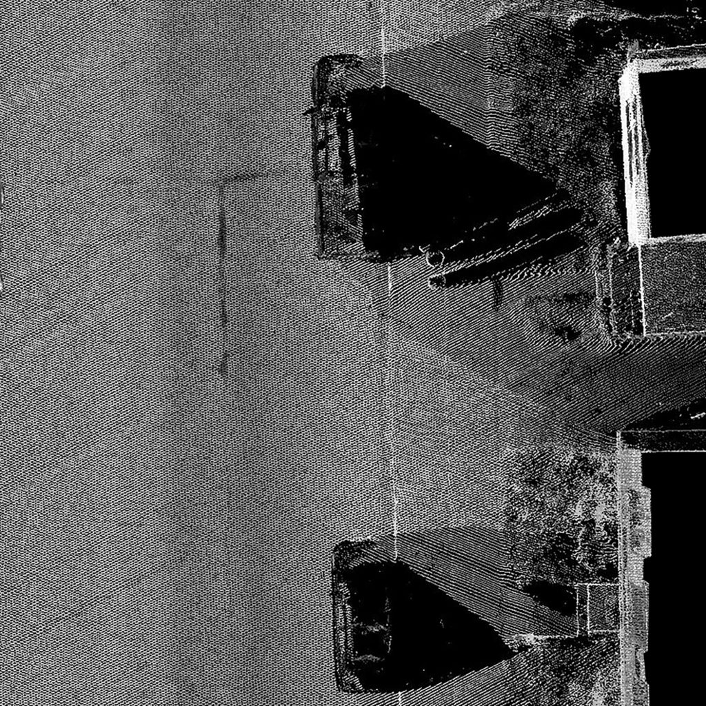
The surfaces of our environments are scanned, stored, monitored, cross-referenced and monetized. This is done by governments, militaries, corporations and you. It is done by satellite imaging, LiDAR scans, Google Street View, Bluetooth beacons and what was formerly known as photography. With all shifts in technologies of mediation, a residue is spit out. In the case of our scanned environments, this excess is the very real space lost between and behind the discrete instances of scanned points. This loss manifests itself, as shadows, as gaps where scans skip and stutter in attempts at achieving fidelity. There is an architectural concept that relates to these hidden zones, which emerged initially as a graphic abstraction in architectural representation. The shadows that hide behind and between the scanned imaging of the surface can be understood as a transformation of the concept known as poché. How architecture can engage these gaps to open alternative possibilities for inhabitation is a deeply political question as reality is increasingly represented through the aesthetics of the digital image.
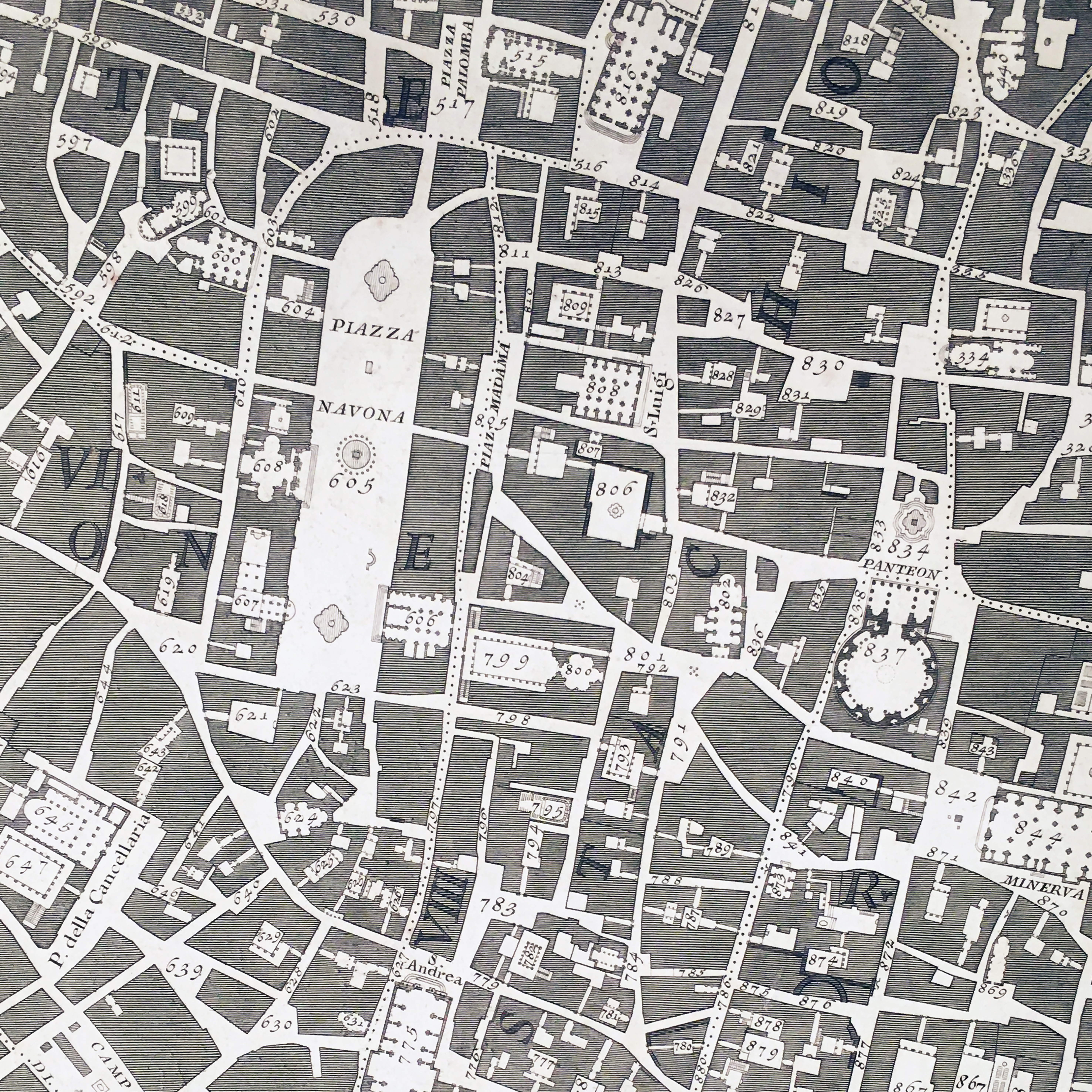
Nuova Pianta di Roma – Giovanni Battista Nolli – 1748
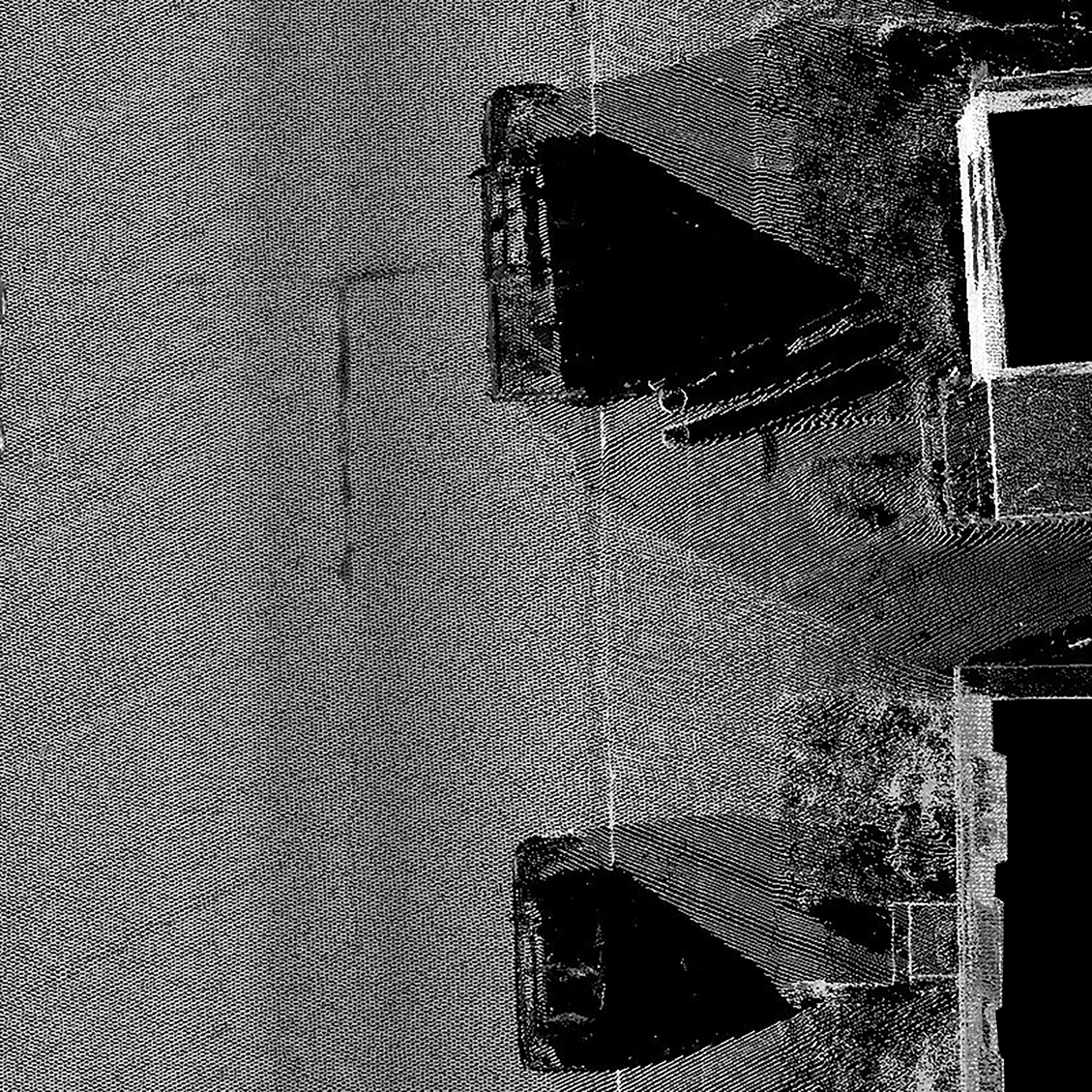
Velodyne Butterfly Scan – LiDAR USA – 2019